
Esri India | News | Press Trust of India
Esri India, Dhruva Space partner for easy access to data from 200 satellites...


Esri India, Dhruva Space partner for easy access to data from 200 satellites...

At Esri India UC 2025, discussions around the innovations powered by GIS and AI took center stage. This year’s theme, “GIS – Integrating Everything, Everywhere,” highlighted the transformative role of GIS in unifying data, domains and geographies.

Building Smarter Systems: Growing Role of GIS in Gas Distribution

Spatial technology is becoming a core technology for burgeoning quick commerce (qcom) firms as well, helping them to...

With the help of enhanced predictive analytics and newly released pre-trained models, GeoAI is paving the way for the future of geospatial intelligence.

India Global Innovation Connect (IGIC) 2025 brought together the brightest minds from across the world to initiate powerful conversations.

Geospatial tech and AI are indispensable for national security.

When it comes to geospatial technology in the country, Esri India is a heavyweight you can’t ignore.

The success of military actions largely depends on having access to accurate data and real-time or short-span analysis and converting these into ‘actionable insights’.

How GIS Enabling Land Record Digitization in India.

Geographic Information Systems are undergoing rapid transformation with the advent of artificial intelligence, redefining the way geographical data is analyzed and used.
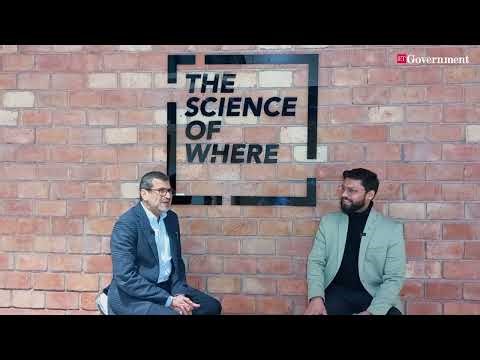
An engaging interaction on "How GIS Technology is Revolutionizing Governance in India"

A Webapp, https://kumbhlocator.esri.in/, has been launched by Esri India to help pilgrims navigate and enjoy their visit to the Maha Kumbh Mela.
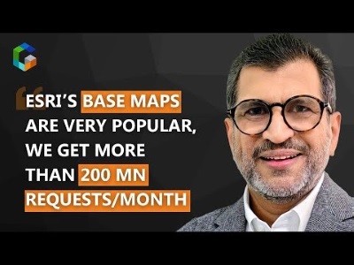
An engaging conversation on "how the company uses geospatial technology and AI to transform decision-making across sectors.

GIS enables ‘Geodesign’ to achieve optimum design based on geographic attributes and functional requirements of the urban area.

Year End Comments from Industry Leaders.

Unlocking growth in FMCG through location data insights.
Experts point to GIS as a powerful tool for monitoring and mitigating pollution.
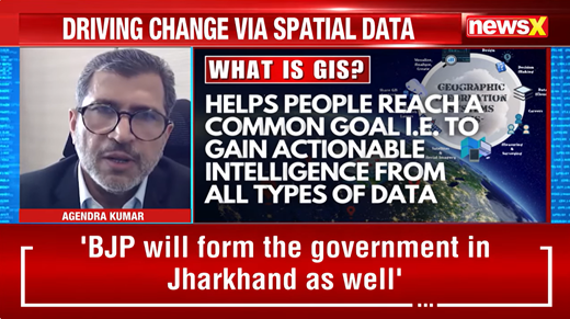
Interaction on how GIS is revolutionizing industries and helping us solve the pressing challenges of today.

Globally, the GIS market is set to grow from its current size of approximately USD 11 billion to USD 24.61 billion by 2034.
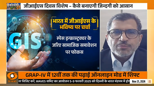
Interaction on GIS' current and future capabilities.
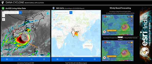
To provide critical insights about the movement of the cyclone to authorities and the public at large, Esri India has launched Dana Cyclone Monitoring Application.

Indo ArcGIS Business Analyst is a location intelligence solution suite designed to aid government organizations in making data-driven smart decisions.

IPE Global, along with Esri India, launched a tool to help local authorities take appropriate action in mitigating the impact of natural calamities.

How to tackle real-world challenges with GIS in action.

Leveraging cutting-edge technologies like Esri’s ArcGIS Reality, users can now generate highly precise 3D meshes, true orthos, and point clouds.

Today’s smart infrastructure projects necessarily warrant the usage of advanced technologies such as GIS, BIM, and digital twins.

Esri India User Conference Announcement.
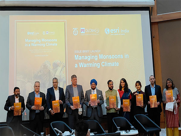
The study highlights a rise in both the occurrence and severity of extreme weather events over recent decades.
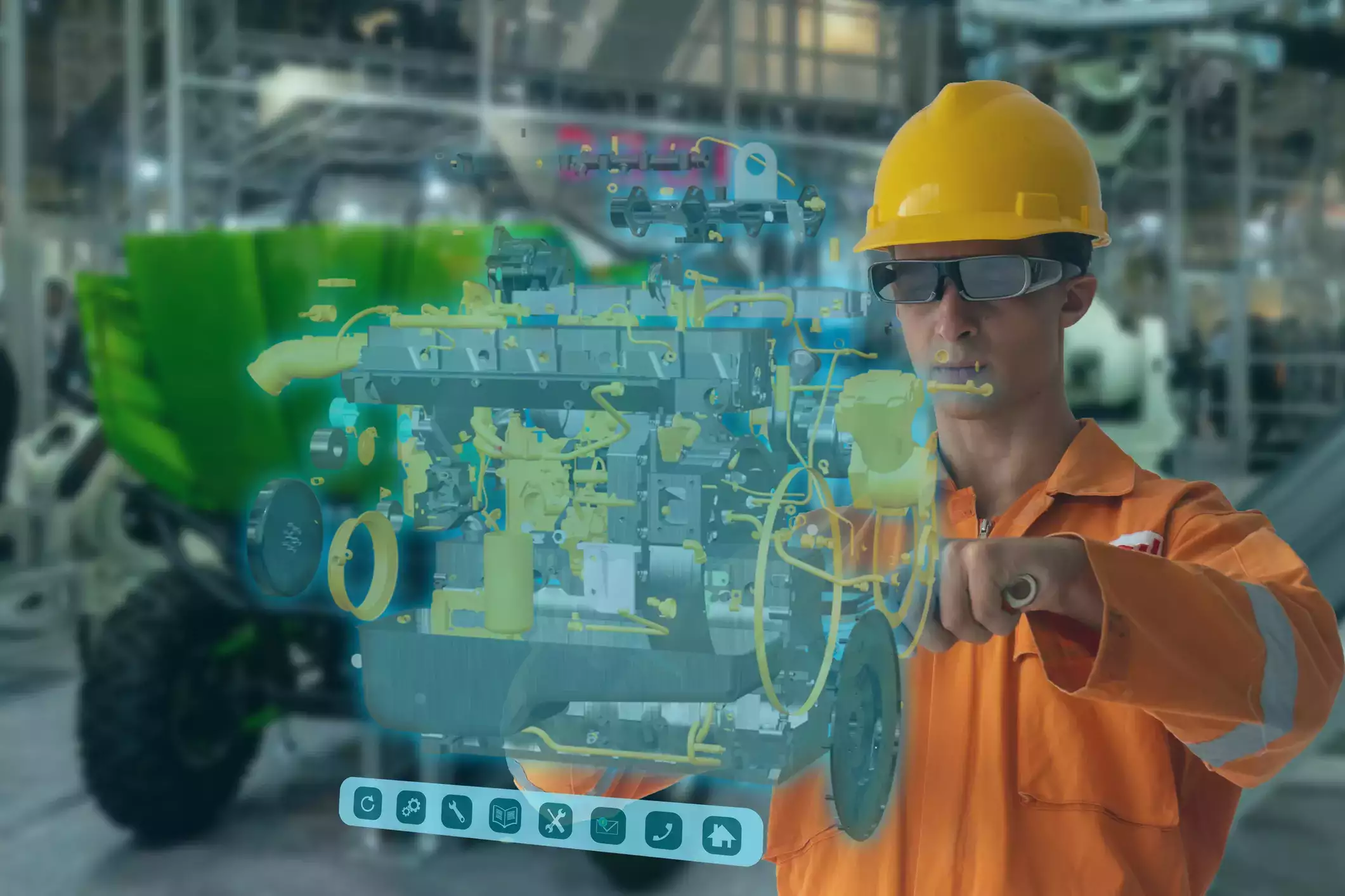
In-depth: Will India’s bet on 5G, 6G-driven digital twins pay off?

CBSE launches entrepreneurship competition for school students, "Youth Ideathon 2024"
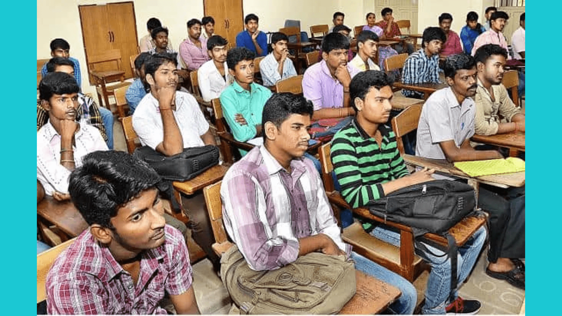
Training in GIS equips students with a versatile skillset that is highly valued in the modern world.
It has been a constant endeavor for Esri India to equip young individuals with technical expertise through specialized initiatives.

GIS and Natural Resource Management

Remote sensing and Geographic Information Systems (GIS) play pivotal roles in both assessing land degradation and facilitating its restoration.

Esri India: Driving Progress with Advanced Geospatial Technologies in Diverse sectors.
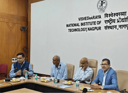
The Master Mentors Geo-enabling Indian Scholars (MMGEIS) program, which is the brainchild of Esri India, and the Centre for Knowledge Sovereignty (CKS) was launched in December 2023.
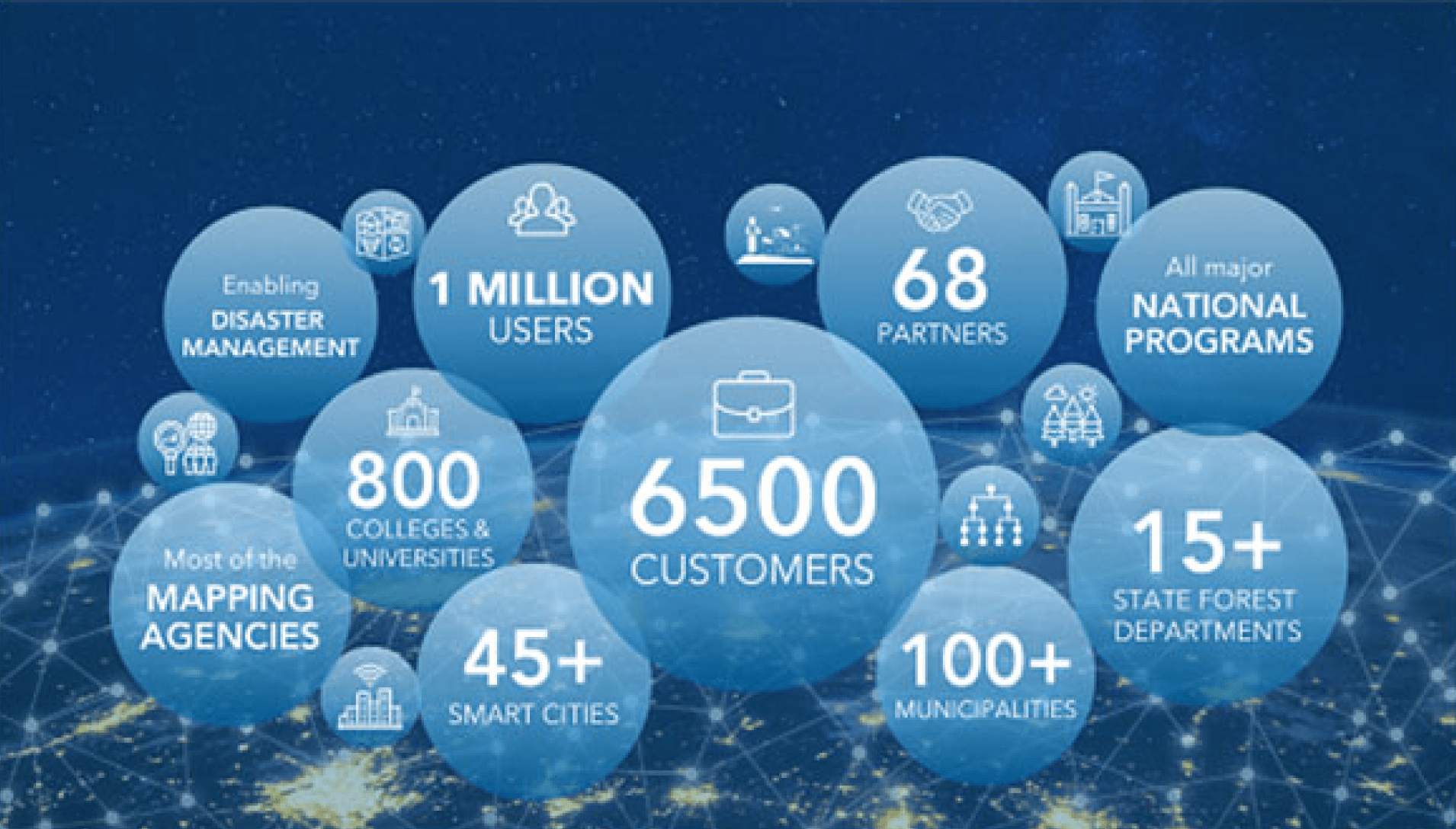
Esri India achieve this milestone of having a million users of Esri technology in India.

Esri India's solutions are enabling telcos to achieve more effective outcomes.

India-WRIS provides authoritative and consistent data and information on India’s water resources and allied themes for effective management of water resources in the country.

India lags behind in geospatial patents but is catching up.

A BITS Pilani alumnus, Agendra possesses over 33 years of cross industry experience working with numerous organizations, and...

Esri India's GIS: Pioneering precision in manufacturing - Manufacturing Today India

Industry Reactions on Interim Budget Speech by FM Sitharaman.

Emphasis on skill development must to encourage adoption of geospatial technology.

Empowering Tomorrow: Celebrating National Youth Day

Geospatial Horizons 2024: Trends and Transformations in GIS

With population explosion and freight traffic expected to double by 2050, the dependency on railways is only going to...

GIS – An essential system for economic growth - ET Edge Insights

This article delves into the power of geospatial data & technology as the driving force behind the digital transformation of power utilities....

Esri India partners CKS to launch new program to improve geospatial technology skills, innovation in India.

काठमाडौं । नेपाली बजारमा अमेरिकी मन्टिन्यासनल कम्पनी इन्भाइरोमेन्टल सिस्टम्स रिसर्ज इन्स्टिच्युट (ESRI) काे भौगोलिक सूचना प्रणाली

Esri (the Environmental Systems Research Institute), a company that has become synonymous with the advancement of geospatial technology.

Multi Modal Connectivity to Boost Indian Economy.

As the cornerstone of enterprise success, location intelligence enables organisations to unlock the true value of their data.

From enabling better planning, management and governance to providing improved and secure solutions, the digital twin concept is being valued for what it can really do.

Sustainability stands as a paramount goal, and technology, especially location technology, is a linchpin in achieving it.

India becomes the first nation to reach the uncharted south pole of the Moon, a mission that is bound to advance the country’s space ambitions and expand knowledge of lunar water ice.

Spatial information systems like Esri’s ArcGIS Utility Network are enabling utility companies to map, analyze, and share data in the context of location.

The 2022 policy made it easier for the industry, users, and academia to collect, process, store, use and share geospatial data.

Leaving behind decision-making based on hunches or incomplete information, modern GIS can empower the AEC sector with rich data and insights with a 360-degr...

The partnership between Esri India and ideaForge will allow users to deploy drone solutions with GIS to solve complex problems in AEC, forestry, agriculture, mining, transportation, utilities, and defence.

ArcGIS Business Analyst is a unique solution comprising data, maps, workflows, and infographics that will enable businesses...

Drones World Special Editor Dr. Pranay Kumar in conversation with Agendra Kumar on challenges and opportunities within the drone industry.

Geospatial thinking plays a critical role in building resilience and sustainability.

The much-awaited National Geospatial Policy was recently announced by the government. The policy aims to take India to a leadership position in using geospatial data and technologies for economic growth.

Esri India has always endeavored to curate industry-specific solutions to align with current business needs, helping enterprises to maximize their investments in location-based data and technology.

Agendra Kumar shares view on how the budget has set ground for enhanced adoption of geospatial technologies among diverse industries.

Esri India, the country’s leading Geographic Information System (GIS) Software & Solutions provider, has signed a Memorandum of Understanding (MoU) with TEXMiN Foundation to set up a Geospatial Excellence Centre at the Indian Institute of Technology (Indian School of Mines), Dhanbad.

Esri India, one of the country’s leading Geographic Information System (GIS) software and solutions providers, on Wednesday (January 18) unveiled Policy Maps for its annual flagship event, the User Conference. As per Esri India, the Policy Maps will facilitate data-driven policymaking in India.

We are trying to drive a 30 per cent reduction in per capita carbon footprint by 2030. This can be done by shifting to electric vehicles or public transport, switching off electrical appliances when not in use, higher use of biodegradable materials and cutting down packaged food items.

कार्बन फुटप्रिंट के बारे में बताएगा CarbonAware ऐप । हिंदी और अंग्रेजी में CarbonAware ऐप।

The National Geospatial Policy unveiled by the government asks ministries and departments to ''increasingly engage'' the private sector for creation and development of geospatial data required by them under the liberalised regime rather than use Survey of India as an intermediary.

The policy provides adequate focus on innovation, involvement of the private sector and presents a time-bound set of actions.

GIS technology is helping decision-makers, both in the government and private sectors, in using location-based analytics and integration with other business systems.

Organizations will be now able to procure Cloud infrastructure, Indo ArcGIS Pro and Enterprise software, and managed services from Esri India.

We have curated processes to minimise the impacts of talent loss and ensure smooth transition periods in the organisation. Strong HR processes enable us to ensure that employees stay productive and competitive.

There are multiple reasons why GIS is playing a vital role in implementing and tracking progress on the UN’s seventeen Sustainable Development Goals (SDGs) and their many targets and indicators.

GIS technology and geospatial infrastructure will play a pivotal role in helping Telecom Service Providers (TSPs) in designing and managing their networks, assets, and operations in an integrated way, and be agile enough to grow as their business requirements change, while ensuring next-generation customer experience,” added Agendra Kumar, MD, Esri India..

Digital twins can help the utility companies to overcome the smart grid challenges and achieve optimal operation.

GPS tolling must address accuracy, privacy concerns first.

The partnership between Esri India and ideaForge will allow users to deploy drone solutions with GIS to solve complex problems in AEC, forestry, agriculture, mining, transportation, utilities, and defence.

Esri’s GeoAI helps in discovering patterns and relationships between different kinds of datasets. The combination of AI and spatial analysis is helping industries to simulate outcomes in diverse scenarios, and it’s evolving in fascinating ways.

we strive to empower the youth with technical competence through unique initiatives like the Esri India Young Scholar program, GeoInnovation, etc.

To comply with the government’s updated geospatial policy, Agendra Kumar, MD - Esri India, consolidates his holding in the company to over 51%.

In a chat with CIOL, Agendra Kumar (Managing Director, Esri India) talks about how he has navigated the art of management through the pandemic, and Esri India's focus areas for the year 2022.

As part of the strategic alliance, Genesys will leverage Esri India's technology platform for 3D modelling, data analysis, and solution development.

80% of Indian enterprises have kept 5G at the top of their priorities list and GIS will be the backbone technology for India’s 5G success story.

Agendra Kumar, MD - Esri India, highlights how a ‘Geographic Approach’ to problem-solving is the 'disruptive thinking’ that is needed to support advancements in disruptive technologies.

In order to scale drone adoption in India, there is a need for a solution or an ecosystem that simplifies drone flying, data capture, processing, and consumption, shares Agendra Kumar, MD, Esri India, with CXOtoday.

As a result of this partnership, Esri India's ‘Indo ArcGIS on Cloud’ will now be available on RailTel Cloud, giving customers the advantages of scalability, agility, and cost-efficiency.

Nearly 200 students from across the country participated in Esri India's Young Scholar Contest, showcasing innovative applications of GIS technologies in projects related to health inequity, social media data analysis, groundwater level assessment, and more.

A scintillating discussion on the subject was held with some of the biggest names in the industry, namely, Agendra Kumar, Managing Director, Esri India, Ashish Agrawal, Director, Resurgent India Limited, Anshul Rai, Founder, Earthwise Investors, Rajendra Shrivastav, President, AES India, Sanjeev Aggarwal, Founder, Managing Director & CEO, Amplus Solar.

As economies and organizations script success stories, one of the unsung factors is the context of location and its impact in defining these successes. Contextualization of location is inherent to the way humans think and do things.

The Cover Story of the Construction Times March 22 edition explored the key proposals in the Budget for the construction, real estate and infrastructure sector. Agendra Kumar, MD, Esri India shared insights on how Esri India, with its multiple offerings, is equipped to aid planners, architects and designers achieve higher efficiencies in their infrastructure projects.

Agendra Kumar, MD, Esri India, told Telangana Today in an exclusive interview, “We have taken part in many critical national projects. We have worked with ISRO, NRC-Hyderabad and many other organizations. We make software and solutions to meet the Indian market needs. We are working with governments and private organizations towards sustainable actions."

In an exclusive interview with Geospatial World, Agendra Kumar, MD, Esri India shares what trends are shaping the GIS industry in India and how it will make a larger impact in the times to come.

Dr. D. Vasudevan, Chief General Manager, Varanasi Smart City describes ArcGIS powered Kashi Geo Hub as an excellent tool for collaboration and decision-making in a webinar on ‘GIS Ushering Smart Cities’, organized by Esri India.

NRIDA, the nodal implementation agency of the PMGSY scheme signed MoU with 3 renowned GIS firms, Esri India, MapmyIndia, DataMeet & collaborated with Gati Shakti for releasing the Rural Connectivity GIS Data in Public Domain.

2022-23 looks like a very promising year for the Indian economy and will lay a strong foundation for a new ‘Geo-Enabled Era’, shares Agendra Kumar with TOI while giving a perspective on Budget 2022.

The Union Budget 2022-23 presented the vision for new India in a progressive light with an emphasis on technology for all-around development. Geospatial Media and Communications covers Agendra Kumar’s reaction to the Budget.

The Union Budget 2022 reinforces the adoption of new age technologies such as artificial intelligence, and geospatial technologies. DATAQUEST captures Agendra Kumar’s reaction to the announcement.

Watch Agendra Kumar, MD, Esri India talk with CNBC Awaaz about the importance of geospatial technologies & drones for a stronger economy. Site Scan for ArcGIS is an apt tool to make the expectations a reality.

India is going to play a major role in the drone market, especially with the production-linked incentive (PLI) scheme in place said Agendra Kumar, Managing Director, Esri India.

New mapping guidelines issued by GOI in February 2021 liberalise the use of geospatial data in the country. With the freedom to collect, generate, disseminate, publish and digitise geoinformation, the stage is set for a long-awaited emergence of contextualised intelligence.

“There has been a transition plan that we have initiated,” Agendra Kumar said. “In between we had a full foreign holding and now it is coming down. I have invested money in this company as well and now have 35% shares. I am looking at taking the stake up to 60% and hope to cross 50% within six to eight months.”

Watch Agendra Kumar on DD India Program In Focus discussing SVAMITVA SCHEME- Survey of Villages, Abadi and Mapping with Improvised Technology in Village Areas.

Agendra discusses with DD News on key factors contributing to increasing land slides incidents and how GIS technology can help us identify vulnerable areas and take actions to save more lives.

Geographic Information System (GIS) and geospatial technologies are playing a critical role in aiding economic growth and dealing with disasters, says Agendra Kumar, MD, Esri India

Esri India is actively involved in bringing better technology and guiding smooth run for modern urban infrastructure of future smart cities that are using GIS technology.

An industry veteran with over three decades of experience in the IT industry, Agendra has been promoting the use of geospatial technologies in the country. Under his leadership, Esri India has partnered with various government and private organizations to execute critical and transformative projects using Esri’s GIS (Geographic Information System) technology.

GIS technology has a myriad of uses in areas such as disaster management, healthcare, emergency management, public safety, and land management among others. The role played by GIS technology in tracking the recent cyclone YAAS cyclone is a recent example that most people are aware of.

Analytics India Magazine caught up with Agendra Kumar, Managing Director, Esri India, to understand location intelligence India’s GIS landscape and Esri’s innerworkings. “With the new Geospatial Policy in place, we foresee an increase in data availability that will further fuel application development."

Information and communication technologies (ICT) have redefined the order of the world in many ways in the 21st century. With its footprint across governance and businesses, ICT connectivity has transformed the way we see, the way we think and the way we work.

Epidemic/disease outbreak management has been an important application of GIS. Even during normal times, it is part of people’s lives in the form of maps, telecom services, utilities such as electricity, water, in healthcare, weather applications and agriculture.

Esri India has created a map to follow Cyclone Yass Live Path. The map is built with ArcGIS Online, Esri’s mapping and analytics system, and provides updates on the weather, wind speed, number of households and population in the area. The map is consolidating the information from various authoritative feeds and sources for an integrated view on the movement and impact of Cyclone Yaas.

As a part of their transformational journeys, cities are strengthening their geospatial infrastructure to unleash the power of spatial analytics, Internet of Things (IoT), big data and artificial intelligence (AI) to improve the quality of life for their citizens and strengthen resilience.

Esri, a provider of Geographic Information Systems (GIS) software and solutions to various government and private entities has been in India since the mid-1990s. In an interview over Zoom, Kumar discusses the new mapping policy, initiatives around Covid, challenges for mapping companies and more.

Geospatial infrastructure is now widely acknowledged and accepted as a critical component for sectoral development and economic growth. With enhanced awareness and affordable access, governments and enterprises today rely on location-based information more than ever to support strategic priorities, making decisions, and monitoring outcomes.

The use of maps and mapping technology within the transport industry is growing significantly. Location is vital to many of the operations that railways / metro needs to carry out, hence, the use of GIS (Geographic Information System) is the optimal means for centralizing and coordinating these activities.

During tough times, tough leaders survive. And along with them survives their companies. India’s leading Geospatial Information Systems (GIS) solutions provider Esri India Technologies (Esri India) managed to hold their ground and grow their business during the pandemic. We talk to Mr. Agendra Kumar, President, Esri India to understand their journey in the times of COVID-19 pandemic.

India and the United States today signed a long-pending agreement for geospatial cooperation that will provide a deadlier edge to Indian missile systems, even as they decided to hold the inaugural Industrial Security Annex (ISA) summit later this year to further cement the two nation’s defence trade and technology cooperation.

Situational analysis with real-time data in a spatial context is critical to understanding Vector diseases, causative factors and their interrelationships for effective planning, response, decisions and actions for vector control programs.

Location is fundamental to all aspects of business, from deciding where to locate a new store to optimizing a supply chain or creating more engaging marketing campaigns that resonate with the best customers.

GIS has evolved into a ubiquitous technology that is at the heart of all major digital transformation initiatives . Whether its health, agriculture, water, smart cities, utilities, gas distribution, banking, insurance, infrastructure development, manufacturing, logistics, retail, modern e-commerce or consumer apps for transportation or food delivery, GIS is the enabling technology for management.

As the COVID-19 virus spreads across the world and in India, the government has realized that its healthcare segment requires a lot more attention than it has received ever. This has established a visible need for technology transformation of the public healthcare segment with a mission to drive better understanding, enable efficiency, multi-agency collaboration and rapid decision making.

In the past, various government departments, including education, forestry, and disaster management have used geographic information systems (GIS) to map out demographics and asses information to handle calamities and crises. In the private sector, retail store chains and banks use maps frequently to decide the locations of their new branches.

Often considered critical for the retail sector, location is really the underpinning for nearly every economic activity. We may not realise it, but geo-spatial location has become an essential dimension in business and social transactions that permeate our lives.

The conference theme, ‘GIS – Interconnecting our World’, highlighted how this geospatial technology integrates everything and engage everyone to overcome unprecedented business and social challenges.

At least six global giants have backed the city’s War Room, which had recently won praise from the Ministry of Health. Set up by the Bruhat Bengaluru Mahanagara Palike (BBMP) in response to Covid-19 outbreak in the city, the two-month-old command centre has been helping the authorities in decision making and identifying gaps to contain the spread of coronavirus.

Government and other authorities have been using a combination of varied technologies to contain the spread of the virus. GIS mapping software has found a greater purpose in an emergency like the COVID-19 outbreak. Esri, a geographic information company, has been developed a unique dashboard that has been helping the government with timely and accurate location information.

Experts said on Saturday that it is time to reset the Indian healthcare ecosystem by actively leveraging technologies like cloud computing and artificial intelligence (AI) to build products and solutions that can be widely adopted.

India, as a country, has united together in its fight to contain the spread of Coronavirus disease 2019 (COVID-19). As the situation around COVID-19 continues to evolve, multitude of initiatives have been undertaken to reign in the spread.

ESRI's tech based on geographic information system (GIS) is being used by some states to understand the spread of the Covid-19 pandemic and the unprecedented challenges presented by it.

The COVID-19 pandemic is wreaking havoc across the globe and governments all over are looking for solutions to battle the spread of the deadly virus. One such technology that is helping keep a check on the virus is called Geographic Information System or GIS.

In a pandemic situation, a location or a place becomes the basic tenets of an investigation of this kind. The question where becomes equally important with who and when in terms of identifying the infected person. And to answer the question – where– Geographic Information Science, Systems, Software (collectively known as GIS) and methods are the most reliable and valuable.

GIS technology has been utilized by varied set of industry verticals for decades.In a conversation with ETCIO, Esri President Agendra Kumar talks about how the company is helping enterprises in these tough times with decision support by offering them free access to their latest tool ArcGIS Hub.

Esri India has created a similar real-time dashboard to map the spread of COVID 19 cases in India including infectious cases and emerging pattern among population/geographies.

Utility Management
Started in 1969, Esri is a more than 50 years old global company. Esri India Technologies was formed in 1996. In India, government organizations have been using their software since 1980s. With a fairly large customer base, Esri India works with national mapping organizations like Survey of India, Geological Survey of India and National Thematic Mapping Organization.

In a recent turn of events, the Jammu & Kashmir Government was reported to be mulling over declaring the November 7th, 2019 snowfall as ‘natural calamity’ in the valley. Leaving a trail of death and destruction, the calamity claimed at least 7 human lives.

Finance Minister Nirmala Sitharaman said that they will be encouraging the manufacturing of mobile phones, semiconductor packaging and electronic equipment. The government of India also took other actions in order to help the tech industry.

Esri is a market leader that aims to deliver GIS, Mapping and Location Analytics solutions to its customers, transforming how organisations identify opportunities and unlock potential to improve business results.

This year, on 13 November, the world is celebrating GIS Day. GIS stands for ‘Geographic Information System’, as a technology, GIS is best positioned to understand ‘Where’. In other words, ‘where’ is the best location to build a wind farm, predict regions liable to flooding or even plan the most efficient logistics route. Simply stated, GIS can collate, display and then analyze location or spatial

Esri India User Conference outlined the imperative and integrated role of GIS in realizing the government’s vision for an inclusive and sustainable growth across various regions and sectors.

Esri India concluded it’s flagship event, Esri India User Conference (UC) on 11th September. Centred on the theme, “GIS: Inspiring What’s Next”, and spanned across three cities – Kolkata, Hyderabad, and Delhi-NCR, the 19thedition of the User Conference witnessed participation of over 80+ speakers and 2500+ GIS users.

B-Nest, a venture of Bhopal Smart City Development Corporation Limited announced a strategic partnership today with Esri India, India's leading Geographic Information System (GIS) software and solutions provider. This partnership will fuel the growth of GIS focused start-ups from Madhya Pradesh and enable them to innovate new solutions for complex challenges India is facing and scale them further

Esri India announced as winner in “Innovative Enterprise Solution” category at Aegis Graham Bell Award 2017, honoring the best innovation in the ICT domain in India. Esri India has been applauded as winner at the 8th edition of Aegis Graham Bell Award at NDMC Convention Center, New Delhi.

PEC University of Technology, Chandigarh and Esri India has launched a Centre of Geospatial Excellence (CoGE) to impart GIS skills to graduates and working professionals through a set of comprehensive Geospatial education programs.

T-Hub - a startup incubator set up by the Telangana government today announced the launch of 'GIS Innovation Hub' (GIH) for the start-ups belonging to the capital Hyderabad. The facility was inaugurated by Jack Dangermond, co-founder, president and CEO, Esri Inc.

The launch was done at ESRI India’s User Conference 2017 on 19th of January where R2 showcased its revolutionary technology. ESRI has recognized R2 as an emerging business partner, thereby granting R2 access to such marketing and branding events.

The world leader in mapping technology, Esri, kickstarted its 2017 India User Conference in New Delhi today with a major announcement that its flagship Cloud-based geographic information system, ArcGIS Online, will soon be available in Hindi and other Indian regional languages.

These startups are using digital maps to do bigger things than find out the nearest coffee shop. Innovation in these areas however come at a great price, literally..."That’s why we work with Esri India as one of their emerging business partners,” says these entrepreneurs.
Find your local Esri India office and get answers for your questions.
Search available positions, or contact our human resources team.
Talk over the phone