
Registrations are Closed
Field Apps in ArcGIS: Enhancing Field Data Collection and Analysis
March 19, 2025 | 11 am - 12 pm IST
Field Apps in ArcGIS: Enhancing Field Data Collection and Analysis
In the realm of Geographic Information Systems (GIS), field data collection plays a crucial role in gathering real-time information from the field. ArcGIS offers a suite of Field Apps designed to streamline data collection, enhance spatial analysis, and improve decision-making processes for organizations across various industries.
Overview
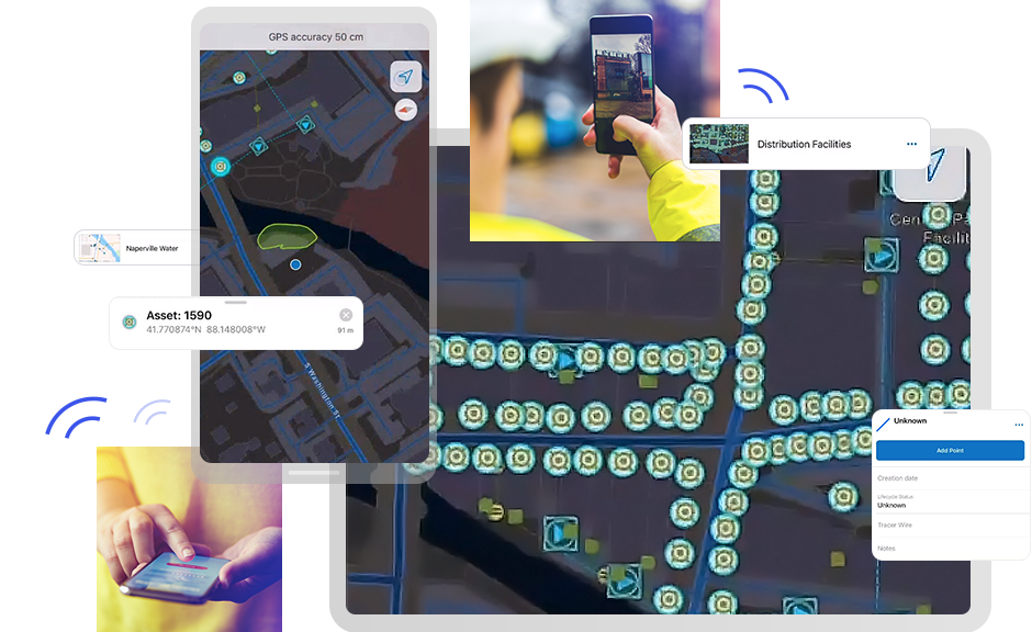
Field Apps in ArcGIS are specialized tools that empower field workers to collect, edit, and update spatial data directly from the field using mobile devices. These applications are tailored to meet the unique needs of field operations, enabling seamless integration with the broader ArcGIS platform.
Key Capabilities and Architecture
- Offline Data Collection: Field Apps in ArcGIS allow users to collect data even in offline environments, ensuring continuity in data capture.
- Real-time Collaboration: Facilitate real-time collaboration between field workers and office-based teams for efficient data sharing and decision-making.
- Custom Forms and Workflows: Customize data collection forms and workflows to align with specific project requirements.
- Integration with GIS Data: Seamlessly integrate field-collected data with existing GIS datasets for comprehensive spatial analysis.
How to Utilize Field Apps in ArcGIS
- Data Collection and Integration:
- Create projects and configure data collection forms.
- Integrate field data with ArcGIS Online or ArcGIS Enterprise for centralized data management.
- Spatial Analysis and Visualization:
- Visualize field data on interactive maps to gain insights into spatial patterns.
- Conduct spatial analysis to derive meaningful conclusions from field-collected information.
- Enhanced Decision-making:
- Leverage field data to make informed decisions and optimize operational workflows.
- Utilize location-based insights for strategic planning and resource allocation.
Who Can Benefit from Field Apps in ArcGIS?
Field Apps in ArcGIS cater to a diverse audience, including:
- GIS professionals seeking efficient field data collection tools.
- Field workers across industries such as utilities, environmental services, and public safety.
- Researchers and industry professionals aiming to enhance data collection processes and spatial analysis.
By harnessing the power of Field Apps in ArcGIS, organizations can streamline field data collection, improve data accuracy, and leverage spatial insights to drive informed decision-making processes.
Speaker

Neha Kshirsagar
Esri India