The mosaic datasets are used to manage, display, analyze, serve, and share imagery and raster data. The document states the workflow to establish an end-to-end workflow of mosaic dataset i.e., creation of enterprise geodatabase to publishing the mosaic dataset as service and auto append the images to the mosaic dataset periodically.
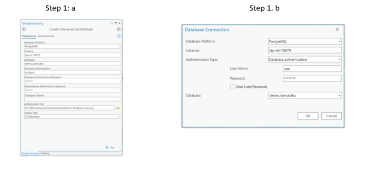
Step 1. Create Enterprise Geodatabase and add it to ArcGIS Pro the client application through Add Database Connection.
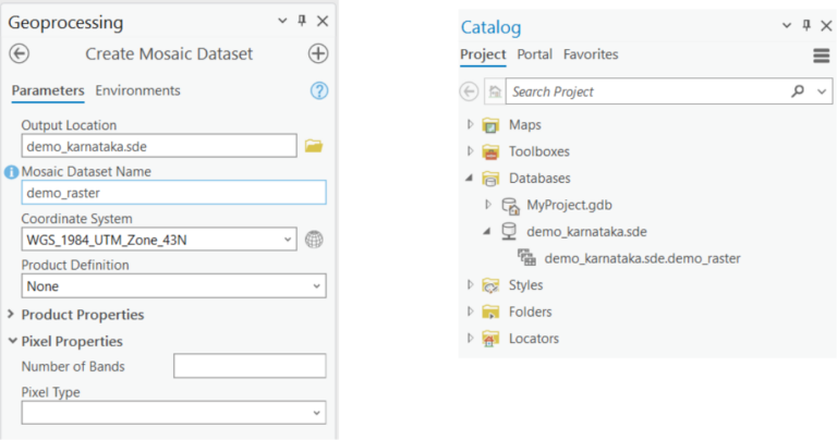
Step 2. Create Mosaic Dataset in Enterprise Geodatabase
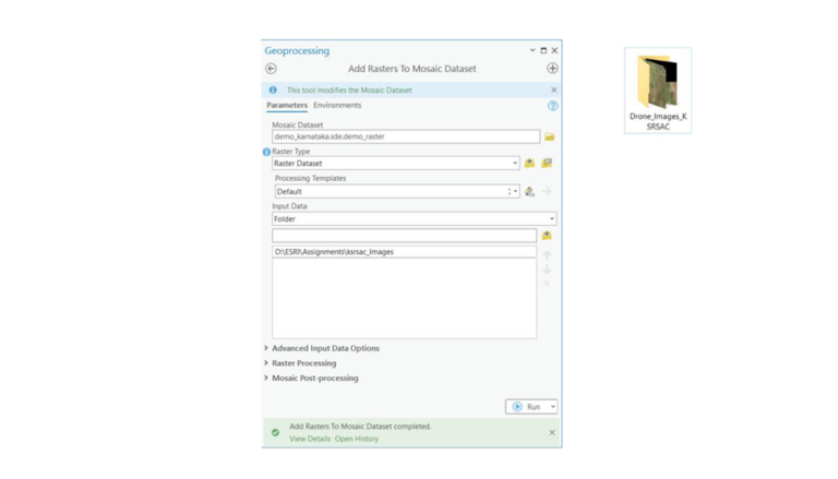
Step 3. Add Raster to the mosaic dataset from the folder contains Images that saved in the server
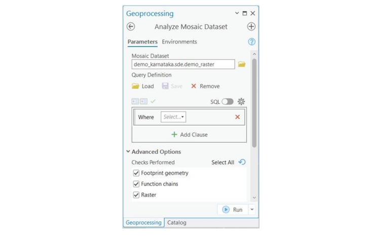
Step 4. Analyze Mosaic Dataset to ensure that the mosaic dataset is functioning properly and efficiently
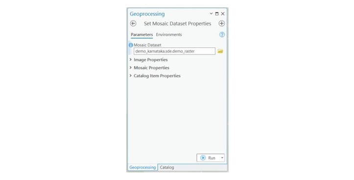
Step 5. Set Mosaic Dataset Properties with preferred settings that defines the defaults for displaying a mosaic dataset and serving it as an image service.
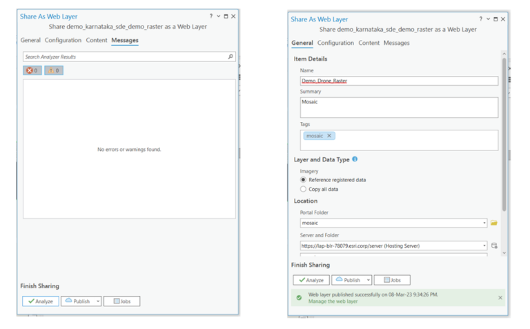
Step 6. Share as web layer – The mosaic dataset can be published with following settings
- Has live data
- Reference Registered Data
- Register Data source with the server
- Analyze and then publish
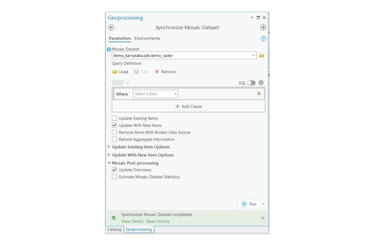
Step 7. Synchronize Mosaic Dataset
Synchronizes a mosaic dataset to keep it up to date. During the process, in addition to syncing data periodically, you can update overviews if the underlying imagery has been changed, generate new overviews, and cache, and restore the original configuration of mosaic dataset items.
Step 8. Refresh Service – Refresh the image service if it is not updated after synchronizing the dataset.

As part of the Presales team, I design India-specific GIS solutions for our customers.
