“Those who tell the stories, rule the world.” – A Native American Proverb
Maps have always told stories, they have just never done so, quite like this. If you have a story to tell and ‘where’ it takes place is a big part of the story, ArcGIS StoryMaps is the way to tell it.
StoryMaps is a powerful tool, a web-based application that allows you to create interactive and engaging stories over the web by combining maps, images, videos, and text. Whether you want to tell a story about a place, an event, a topic, or even yourself, StoryMaps provides you with the tools to create captivating narratives that can be easily shared with others. From epic road trips to your favorite local restaurants, your experiences can inspire and engage people everywhere. Everyone loves a good story, and your stories are waiting to be told. In this guide, we will explore how to use StoryMaps to create your own multimedia-rich stories.
You can make a StoryMap in minutes, no matter what your digital skillset is. You can edit fast and thoroughly customize. You can do it all yourself or work collaboratively in a team as well. Create, share, and publish your StoryMap with a few simple and easy steps and make your mark on the world.
Every story has a place, and every place has a story. Make yours count using StoryMaps.
1.Features of StoryMaps
There are various ways through which Esri StoryMaps can give you an advantage in storytelling over the conventional ways of narrating a story. Few of those exclusive features of StoryMaps are as follows:
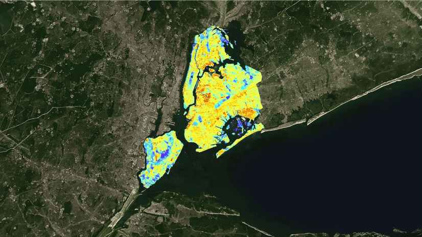
a. Inclusion of Maps
Maps give context to your story with places. Take your readers on a journey to any destination at any time. StoryMaps offers you access to cutting-edge mapping technology, allowing you to lead your audience to your favorite places, showcase trends, or even take them in an interactive tour. StoryMaps allows you to use a map type/theme synchronizing best with your story.
Highlight places or areas of interest. Enhance your maps with pop-ups, images, labels, arrows, and other elements.

Showcase your outdoor activities, such as hiking, running, and cycling, on a map with a terrain profile and activity stats including distance, time, and elevation gain.

Bring your data to life on a custom map. Show how things are related to each other like patterns, and trends.

Browse a library of pre-designed maps related to topics like history, geography, the environment, and climate that you can add directly to your stories.

b. Interactive digital experiences
Want to pull your audience’s attention and make your story more engaging? You can do so by using various Immersives in StoryMaps and create dynamic experiences for readers with ready-to-use interactive elements. Add context to your content easily with beautiful layouts and immersive experiences made in minutes.
Pair descriptive text with large, dynamic media to draw readers deep into your narrative.

Curate a set of places your audience can browse in whatever order they prefer.

Guide your readers to locations one-by-one in an intentional and revealing order.

Conventional slideshows never go out of fashion. Add an interesting aside or an optional deep dive, as a click-through carousel for your audience.

c. Multimedia: Go beyond just words
Tell your story the way you want to, by using a variety of visuals such as images, video, audio and even embeds. StoryMaps comes equipped with everything you need to ensure your story looks great and authentic, the way you want it to be narrated.

d. Frames: A new era of mobile storytelling
Frames are short, engaging stories with photos and maps that are optimized for on-the-go creation and viewing in a way that brings the art of storytelling right to your fingertips. Frame templates distill the very best elements of StoryMaps into the mobile app where the time and place set the stage for your stories.

StoryMaps frames is a mobile-focused storytelling format that allows you to create captivating narratives directly on your phone with the StoryMaps mobile app. Frames are told through a series of text, photos, and maps that create engaging and visually stunning narratives. Whether you want to share funny stories about your day, insights from your latest adventures, or document life’s interesting moments, frames make it simple. You choose what you want to share and create it with frames!
StoryMaps lets you create frames in either of the two options: Timeline and Journey.

Timelines are ideal for chronological picture-focused storytelling. If your story involves a series of events, choosing the Timeline template is a good idea. Share your experiences step-by-step with the timeline template and make connections over time with pictures and dates. You can use the timeline template to recap a recent trip, document the progress of your latest project, or record the growth of your new puppy.

If you’re looking to share a story connected to specific locations, the Journey template is the perfect option. Journeys are perfect for telling short, engaging stories that take your audience on a tour through significant spots, landmarks, and points of interest. Every place has a story, and Journey helps bring those stories to life. One of the coolest features of the Journey template is that with Journey, images are seamlessly integrated with the map. It not only allows your audience to read about different places, but they can also interact with a map while doing so.
e. Themes: Get the look you want
Say good-bye to boring and embrace your inner designer. You can set the mood for your story with different background colors, fonts, button styles, quotes and more. Choose from a variety of ready-to-use themes or quickly create your own easily.
Customize the look of your story as you want as the right appearance sets the tone of your story. With custom themes, you can give your story a look of its own.


2. Getting started with StoryMaps
To start creating StoryMaps, you’ll need to create an account first. Signing up for StoryMaps is as easy as 1 2 and 3.
Step 1: Create a free account with your email or a social login such as Apple, Facebook or Gmail. You shall be receiving an account activation email immediately.
Step 2: Activate your account from the emailed link.
Step 3: Sign in and start creating your very first StoryMap.
- Once you have signed in, you shall be able to see below mentioned webpage wherein you can explore and start creating your very first StoryMap by clicking on the Create button.

- On clicking on the ‘Create’ button, the Story Creator will be launched in the same tab of your browser, the UI of the same will look as below:

- Next, you can explore all the tools described in the above sections by clicking on the (+) button. A menu will pop-up on the screen with a list of tools/features via which you can start creating your StoryMap, such as: Text, Table, Image, Video, Audio, etc.

3. Sharing and Collaborating on StoryMaps
Once you’ve finished creating your StoryMap, you can share it with others by generating a shareable link or embedding it on a website. You can also collaborate with others by inviting them to edit your StoryMap or by sharing it with specific groups or organizations. No matter where your audience is, you can use StoryMaps to connect with them.

To publish your StoryMaps, you can click on the “Publish” button on the upper right corner of the screen. After clicking on the Publish button, you can choose the privacy/visibility level as per your convenience. Whether you want to publish your story for a wide public audience, or just with your friends by just creating a weblink or even just for yourself to edit it later for final publishing.
If you wish for your story to be easily discoverable through searches, consider incorporating targeted keywords or topics into it. This will enhance the chances of your audience finding it when they input those specific terms into the search bar.
You can preview how your StoryMap would look across devices quickly and easily, so that you can give the look and feel as you want to your audience. You can edit and reshare a story as per your convenience as and when you feel so.
And there you are, you have just created and published your very first StoryMaps! Excited to explore more? Do check out the below section of further resources to help you explore ways to create enticing StoryMaps.

4. Conclusion and further resources
So far, we learned that StoryMaps is a versatile tool that allows you to create interactive and engaging stories that combine maps, images, videos, and text. Whether you’re a student working on a class project or a professional looking to communicate your research findings, StoryMaps provides you with the tools you need to create compelling narratives that can be easily shared with others.
StoryMaps is an excellent platform for students to create multimedia-rich stories that combine maps, images, videos, and text. By following the steps outlined in this guide, you can learn how to create engaging and visually appealing narratives that effectively communicate your ideas and research findings. Whether it’s a class project, a presentation, or a personal interest, ArcGIS StoryMaps offers you a powerful tool for storytelling that can enhance learning and communication.
Explore Stories Anywhere!
You can download the StoryMaps app to begin reading stories created by authors around the world. The app is available via the Apple App Store as well as Google Play Store.
See StoryMaps in action on: https://storymaps.com/explore
Help and learning resources for StoryMaps: https://storymaps.com/learn
StoryMaps Blog: https://blog.storymaps.com/

Syed Zubair manages the Training Sales Business for Pan India at Esri India. He loves GIS and exploring new possibilities on how GIS can make a real difference locally and globally. He is passionate about designing user experiences for maps and apps.